Looking at acreage around Odessa and wondering what you might be missing below the surface? In West Texas, the land can look simple at first glance, yet features like playas, caliche, and old well sites can change your plan and your budget. If you understand wetlands, soils, minerals, and permits before you buy, you can move forward with confidence. This guide walks you through the key checks, local rules, and reliable resources for Odessa and Ector County. Let’s dive in.
Odessa land at a glance
Odessa sits in a dry climate with about 13 to 14 inches of rain each year, much of it from summer storms. That weather shapes how land drains and how soils behave over time. You’ll see mostly open rangeland, shallow basins, and man‑made stock tanks. The dry look can be deceiving, so you want to confirm what is on the parcel and what rules apply before you commit. For climate and local landscape context, tap into the Ector County AgriLife Extension.
Wetlands in West Texas: what to look for
In and around Odessa, the most common natural wetlands are ephemeral playa lakes. These are shallow, clay-bottom basins that fill after storms, then dry out. They are important for wildlife and can recharge shallow groundwater. Because playas are seasonal and often dry, they are easy to overlook on a quick visit. Learn more about their role from this overview of playa lakes in the Panhandle and South Plains.
Federal rules and practical steps
A 2023 U.S. Supreme Court decision narrowed which wetlands are federally regulated, so some isolated features may no longer fall under the Clean Water Act. Field teams continue to apply the ruling case by case. If your mapping or site walk suggests wetland signs, get clarity with a professional wetland delineation and, if needed, request a formal Jurisdictional Determination from the U.S. Army Corps. The Corps’ review is the authoritative federal step. See the agencies’ recent update on implementation and guidance from the U.S. Army Corps of Engineers.
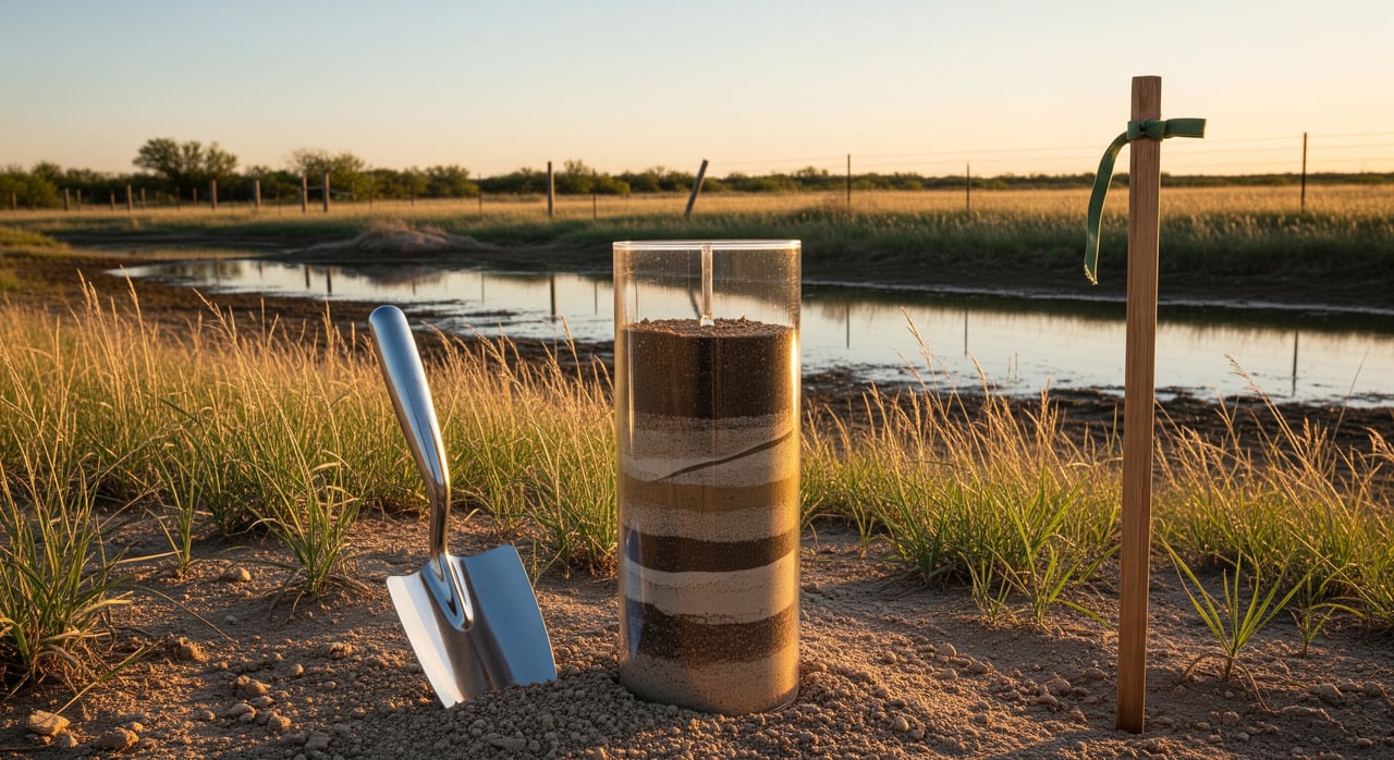
Soils in Ector County: caliche, clays, and building
Local soils often include caliche layers and clay-rich horizons. Caliche can make excavation tougher and can affect septic drainfields and foundation design. Expansive clays can move with moisture swings, so slab and footing design should be based on site data. Start with the county soil survey and parcel-level maps from the NRCS, then follow with a geotechnical study for any planned building. Review the Ector County soil survey reference here: NRCS county soil survey.
Septic feasibility matters early
For parcels outside city sewer, you’ll need an on-site sewage facility (septic) permit and a site evaluation. Soil type, depth to caliche, and lot size drive what system is allowed. Confirm feasibility during your option period so you are not locked into a parcel that cannot support your plans. Start with the Ector County Health Department’s On-Site Sewage (Septic) page.
Oil, gas, and minerals: surface impacts to consider
In Texas the mineral estate is often the dominant estate. That means a mineral owner or lessee may use the surface as reasonably needed for exploration and production, unless limited by agreement. You want to know early if there are active or historic leases, pipelines, well pads, or easements that affect surface use. For an overview of how surface and mineral rights interact, see this Texas A&M Real Estate Center explainer on the accommodation doctrine.
Check wells, injection, and records
Use the Railroad Commission of Texas Public GIS Viewer to search for active wells, plugged wells, pipelines, and disposal or injection wells near your parcel. Long-term injection can bring extra rules or scrutiny in some areas. Start your screening with the RRC’s Public GIS Viewer and well records.
Floodplain, drainage, and utilities
Even in a dry climate, localized flooding can occur around playa basins or low areas after storms. Confirm FEMA flood zones and any local requirements. The City of Odessa offers floodplain determinations and map help on its Floodplain Information page. If you plan to connect to city utilities, verify service availability and steps for new hookups through the City of Odessa utility service portal.
Your Odessa land due-diligence checklist
Use this list to organize your option period and contract contingencies.
- Title and mineral-rights review
- Order a title commitment and review all exceptions. Ask whether minerals were severed. Consider a specialized mineral-title or landman review for high-value tracts. Read about the surface and mineral interplay in this Texas A&M Real Estate Center article.
- Boundary and topographic survey
- Commission a current boundary and topo survey that shows easements, fences, visible utilities, well pads, and flow lines.
- Environmental desktop screening and Phase I ESA
- A Phase I ESA to ASTM E1527-21 is the standard first step for identifying Recognized Environmental Conditions. It also helps qualify you for certain liability protections. See the summary of EPA’s acceptance of ASTM E1527-21 for All Appropriate Inquiry here.
- Wetlands screening and delineation
- Check aerials and wetland maps. If you see potential indicators, hire a qualified wetland scientist and consider a formal Corps Jurisdictional Determination. Learn more about current implementation from the U.S. Army Corps announcement.
- Geotechnical and septic evaluations
- Get a geotech report for foundations and grading. For septic, verify lot size and soil suitability with the Ector County Health Department’s septic guidance.
- Floodplain and drainage
- Check FEMA maps and request a local determination from the City’s Floodplain Information page. Consider an elevation certificate if required.
- Oil and gas wells, pipelines, and injection
- Search the RRC’s Public GIS Viewer for wells and lines. If you find activity, pull records for clarity.
- Cleanup databases and nearby risks
- Screen EPA and state records for nearby contamination, such as historic cleanup sites in the Odessa area. Start with EPA’s archived Texas cleanup listings snapshot. If your Phase I flags concerns, be ready for a Phase II.
- Local permits and utilities
- Confirm if you will use city water and sewer or private well and septic. For city service questions and applications, visit the utility service portal.
- Soil survey and site planning
- Review the NRCS county soil survey to anticipate limitations, then align your site plan with geotech findings.
Three deal-breakers to verify before your option period ends
- Mineral and surface-use exceptions. Confirm mineral reservations, easements, and any active leases so you understand allowed surface uses. See the Texas A&M overview of the accommodation doctrine.
- Septic feasibility. Have a site evaluation and confirm that soils, setbacks, and lot size meet Ector County’s septic requirements.
- Environmental red flags. Order a Phase I ESA and screen nearby sites using EPA’s cleanup listings snapshot.
Make your plan with confidence
Buying land in Odessa rewards careful homework. If you use maps as a starting point, confirm on the ground, and consult the right experts, you can avoid surprises and protect your budget. When you are ready for a clear plan and a process that keeps you in control, connect with Kristy Thurber for buyer representation and step-by-step guidance.
FAQs
What counts as a wetland in Odessa after the 2023 Sackett decision?
- Some isolated, seasonal features may not be federally regulated, but status is case specific, so use a wetland delineation and consider a formal U.S. Army Corps Jurisdictional Determination based on the agencies’ current implementation guidance.
How do caliche and clay soils affect building in Ector County?
- Caliche can require heavier equipment and can limit conventional drainfields, while expansive clays drive the need for engineered foundations, so start with the NRCS county soil survey and follow with a geotechnical report.
How can you check for oil and gas wells on Odessa land?
- Use the Railroad Commission of Texas Public GIS Viewer to locate active or plugged wells, pipelines, and disposal wells, then review detailed records if anything is nearby.
What permits apply for septic systems in Ector County?
- Parcels outside city sewer need an on-site sewage facility permit and site evaluation through the Ector County Health Department’s OSSF program.
Do FEMA flood maps matter in a dry climate like Odessa?
- Yes, intense storms can still cause localized flooding, so check the City of Odessa’s Floodplain Information for determinations and any elevation certificate needs.